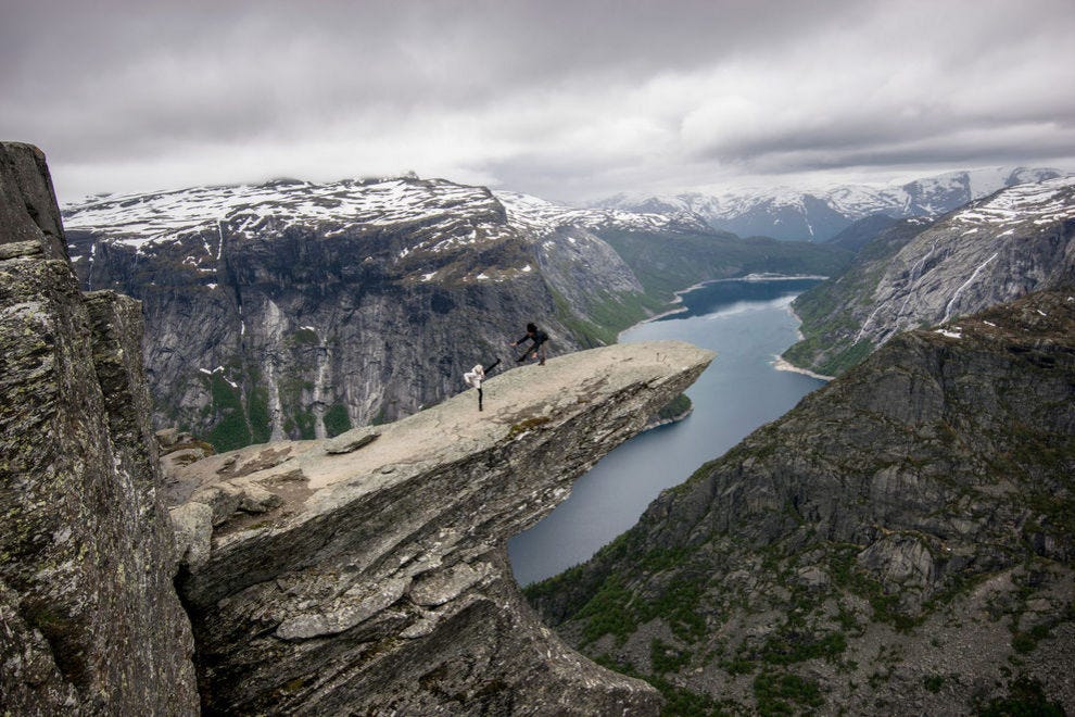
 Hiking to the summit of Trolltunga — Photo courtesy of Jacqueline Kehoe
Don't forget your camera at home. Norway's best hikes lead to views akin to any description of paradise: cliffs rising from the ocean, waterfalls pouring out to sea and glacial streams emerging from pockets of blue ice. Take it easy and slow, or show off your skills – in Fjord Norway, even a casual stroll can lead to a great reward.
Here are 10 amazing hikes full of magical photo ops.
Trolltunga
 Trolltunga — Photo courtesy of Jacqueline Kehoe
If Trolltunga is on your list, it's best to be realistic – this is not an easy climb, and most people complete the 14.5-mile round trip in a minimum of 10-12 hours. The first mile is a steep 1300-foot rocky ascent, and it's where most turn back.
If you can make it past mile three, it's a slow, steady rise from there on out. The best part? The views at the Troll's Tongue itself may not even be your favorite – you'll be hiking along the edge of a fjord, flirting with the clouds, before you even get to that iconic photo op.
Bondhusdalen
 Bondhusdalen — Photo courtesy of Jacqueline Kehoe
There may be perhaps no other hike in the world that offers such great reward for such little effort. Drive through the Bondhusbygda hamlet, pull your car into the parking lot at the entrance to Bondhusdalen Valley, and you're already only 20 minutes away from viewing Bondhus glacier and the most striking talus slope you've ever seen.
An easy walk through a garden of boulders leads you to Lake Bondhusvatnet, a glacial puddle slowly drowning the rocks it displaced thousands of years ago.
Folgefonna glacier
 Folgefonna glacier — Photo courtesy of Pål Hermansen/Folgefonna Breførarlag
You'll need a guide to access this kind of icy terrain, but walking over blue ice and peering into newly exposed crevasses is worth the extra effort of arranging this outing beforehand. FONNA Glacier Ski Resort can hook you up with the guide and the gear, and they'll take you 4,000 feet above sea level and onto ice that's been around for thousands of years (and possibly not much longer).
The challenge here has more to do with your agility on the frozen stuff and your trust in your crampons and ice pick – your heart will pound from the rush, not from your aching muscles.
Lokjelsvatnhytta
 Lokjelsvatnhytta — Photo courtesy of Jacqueline Kehoe
While the views offered at the top of Lokjelsvatnhytta are worth noting (leftover glacial ponds, vistas that run for miles), the best part of making it to the summit after this three-mile, forested trek is sitting down with a cup of coffee at one of the Norwegian Trekking Association's cabins (there's two ultra modern ones up here waiting for you).
The hike involves a few ropes, ladders and streams, so it's best to leave this one to the teenagers and adults.
Glacial potholes at Rullestad
 Glacial potholes at Rullestad — Photo courtesy of Svein Opda
This rocky hike isn't long (2.5 miles), but it's quite steep and watery – the last 300 feet is up a steel ladder, and if it's rained recently, this hike isn't suggested. But if it's dry and you're feeling inquisitive, give this hike a go.
Not only will you likely be the only ones on the path, but you'll be rewarded with some R&R at the biggest "potholes" in all of Europe, where glaciers once stirred away rock, forming giant, empty cauldrons in the mountainside.
Steinsdalsfossen to Lake Movatnet
 Underneath Steinsdalsfossen — Photo courtesy of Terje Rakke / Nordic Life AS / www.fjordnorway.com
When a hike starts from behind a waterfall, it's going to be good. This one is an easy walk from Steinsdalsfossen waterfall (prepare to get misted), where you can park your car and follow the signs for Fjærabygda.
Take it all the way past Nesthus and to the edge of Lake Movatnet (1.5 miles), and grab a spot waterside to take in the cliffs reflecting in the still water.
Langfoss Falls
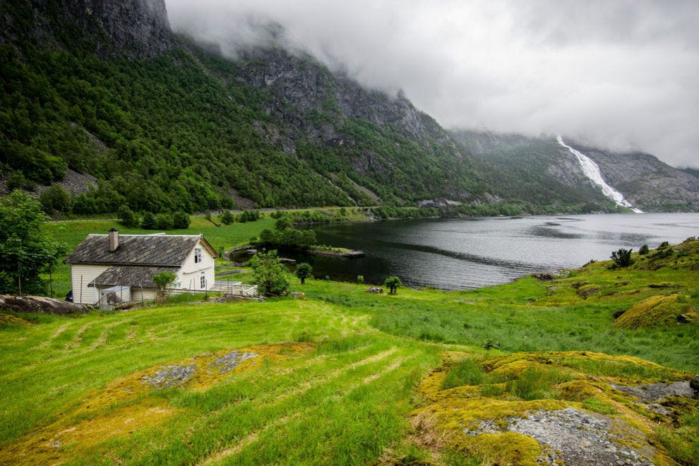
 Langfoss Falls, Eljarvik Farm — Photo courtesy of Jacqueline Kehoe
Falling over 2,000 feet, you'll know Langfoss when you see it. It's the 5th tallest waterfall in the country, and from its peak you'll even be able to see Folgefonna glacier in the distance.
The 2,600-foot ascent will take about five hours there and back, starting at the picnic area on E134 near the Eljarvik Farm. It's best to go on a clear, dry day to avoid traversing muddy terrain – and to get an unparalleled view into the depths of the Åkrafjord at the top.
Mt. Oksen

If meditating on top of a grassy pasture, overlooking a fjord stretching out to the ocean is on your bucket list, keep reading. Mt. Oksen is 3.7 miles each way, but it's quite steep – consider it the price to pay for these fantastic views of the Hardangerfjord.
Drive to the end of road 302, drop off the car and bring shoes that make you feel confident on steep cliffs.
Vivelid - Såtefjell
 Såtefjell — Photo courtesy of Marit Stadheim
It's six miles of rocky tundra and vistas from Vivelid, through Fljotdal, and then to Såtefjell, entering Norway's Hardangervidda National Park. You'll slowly ascend 900 feet as you traverse over the mountains, and be sure to note the fjords and glaciers in the distance.
Stop for a cup of coffee at Vivelid Mountain Lodge if you're here during open season, or make it your waypoint for heading back home.
Steinstø to Bjørke
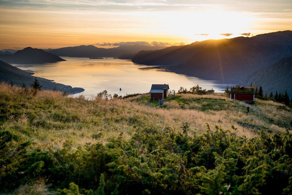
 Bjørke in Hjørundfjord — Photo courtesy of Christiane Flechtner / www.fjordnorway.com
There are six miles of trails near Steinstø, right on the edge of the Hardangerfjord. Take it easy on the forested paths, walk through the Steinstø farm and orchards, and if you feel up to it, head for a steep walk up to Bjørke and Mt. Bjørkeveten.
You're on the tip of a bend in the fjord, meaning it's 180-degree views of the stuff Fjord Norway is famous for, no matter where you look.


